So being curious, I decided to do a little research myself. With the help of Google Earth, Wikipedia and other minor provided links, I looked up on the criterias of creating a Tsunami, it's characteristics, active and powerful tectonic plate borders and the geographical land layout of mainland Singapore and surrounding lands. After an hour's worth of research, I came up with a thesis;
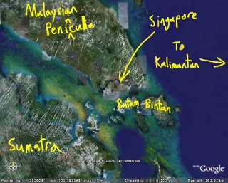
So basically, it's almost impossible for a Singaporean to see his HTB flat attacked by a series of six-storey tall waves.
Almost.
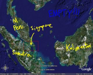
If you look at a zoom out of the map, North-West-West of the radius is not fully or properly blocked by islands.
If you look at this diagram below of Preliminary Determination of Epicenters, you would see that this makes Singapore vounerable to earthquakes from Japan and/or the Philippines (which aparently had so many earthquakes that it covers their respective areas with tonns of symbols, you can't even see the country itself).

So based on my calculations, the best place for the Tsunami eartquake to be located to cause the greatest damage on Singapore would have to be... Here.
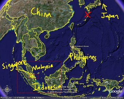 (X marks the spot)
Now giving it a worst case senario of, erm, lets say 7.5 on the rictor scale, lets see how the tsunami travels to South-East Asia...
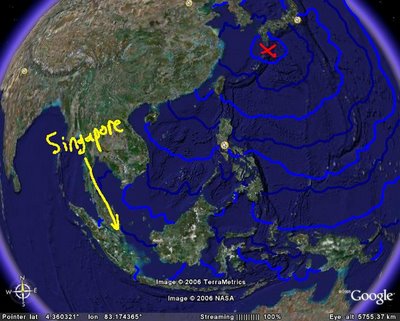
Now let's zoom in into Western SEA and see what's happening there...
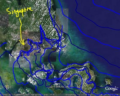
Alright, maybe it's not so clear, but now assuming that the waves can reach as high as 6 storeys (19.2 m) when on land, lets now zoom into mainland Singapore, this time just seeing how the water moves ON LAND...
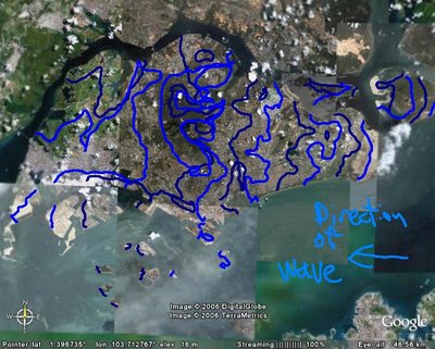
Okay... So acording to another few rough calculations;
~ Singapore has an estimate of 7 hours to be warned and evacuated.
~ That's just about good enough to get 1/4 the population to Kuala Lumpur, assuming that all cars start with a full tank and won't stop for nothing.
~All the Singaporean islands except the mainland, Pulau Ubin, Pulau Ayer Chawan and Pulau Tekong will be completely underwater for about 5-15 minutes each.
~The entire Changi Airport compound will be taken down, so don't be silly enough to try to escape by plane.
~Whole of East Coast will be wiped out. (Lamentations, be afraid...)
~Jurong and Jurong West will be spared from the waters, BUT Jurong East and parts of Jurong would be set aflame, thanks to the oil washed up from the refineries on Jurong Island. (Shil, be even more afraid...)
~All 23 reservoirs will merge as one.
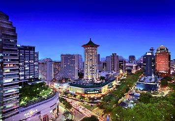
~Our economy will suffer tremedously; The whole City, together with Orchard road, will be fully hit. BUT it may be easy to rebuild from the rubbles; Name me financially important buildings in the Southern Areas that are shorter than 6 storeys
~The Padang Square will be covered with glass fragments from the Esplanade, so the arts will blend with the sports.
~Bukit Timah Hill is the most advised place to run for if you can't drve to KL.
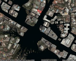
This was the photo NASA took whlie they were watching Orchard road get Flushed Away. By then, their satilite was called Oogle.
And here's a photo from a journalist the day after the incident.
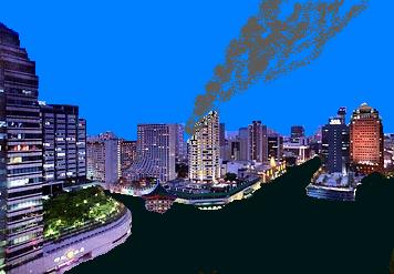
I predict that many will be saved as there would most likely be enough time, 7 hours, to warn the country to migrate to Malaysia, but there will also be the minoirity who will die due to the fact that both bridges to Malaysia will only have 6 lanes each to ferry over 4 million cars to Johor, which by the way will also be hit by the tsunami.
But like I said earlier on, Singapore is well protected by surrounding islands and the Malaysian Peninsula so this theory only has a one-in-a-billion chance of happening. Praise the Lord, I guess...